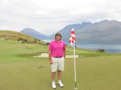
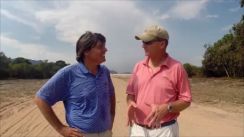
CLICK here for Video Interview with Florencia & Pepe Rolz.
CLICK here for Video Interview with Florencia Rolz, five-time Mexico Women’s Amateur Champion.
CLICK here for Video Interview with Pepe Rolz, Amateur Champion and Guatemala’s Golf Ambassador.
CLICK here for Video of Mayan Golf Club’s 10th Hole Redesigned by Pepe Rolz.
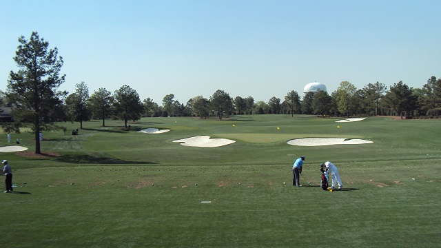
The Mayan Golf Club, started in 1918, is the oldest club in Guatemala. A round here is an exciting round of golf playing amongst active volcanoes and incredible vistas of Lake Amatitlan. Excellent variety of golf holes with no favor to dog-legs right or left. Club hotel on site for those who cannot bring themselves to leave (like me). This golf course hosted a Latino- America event in 2002 and is planning to host a Web.com tournament in its Centennial year of 2018.
Pilar Echevarria was the runner-up at the 2012 Guatemala Open. She won the 2008, 2009, 2010 and 2012 Central American Junior Championships, as well as the 2011 Junior Guatemala Open.
Pacaya is an active complex volcano in Guatemala, which first erupted approximately 23,000 years ago and has erupted at least 23 times since the Spanish invasion of Guatemala. Pacaya rises to an elevation of 2,552 metres (8,373 ft).[1] After being dormant for a century, it erupted violently in 1965 and has been erupting continuously since then.
Pacaya is a popular tourist attraction. Pacaya lies 30 kilometers (19 miles) southwest of Guatemala City and close to Antigua. So far, the last activity reported has been the eruption that peaked on May 27, 2010, causing ash to rain down in Guatemala City, Antigua and Escuintla.
Volcán de Fuego (“Volcano of Fire”) is an active stratovolcano in Guatemala. It sits about 10 miles (16 kilometers) from the colonial city of Antigua Guatemala, one of the Guatemala’s most famous tourist attractions. It has erupted frequently since the Spanish conquest. “Fuego” is famous for being almost constantly active at a low level. Smoke issues from its top daily, but larger eruptions are rare. On August 9, 2007 Fuego erupted spewing lava, rock and ash. A new round of activity began on 19 May 2012, with lava flows and ejections of ash.[citation needed]
On September 13, 2012, the volcano once again began spewing lava and ash, prompting officials to begin “a massive evacuation of thousands of people” in five communities.More specifically, the evacuees, roughly 33,000 people, left nearly 17 villages near the volcano.[4] It spewed lava and pyroclastic flows about 2,000 feet (600 meters) down the slope of the volcano.
Volcán de Agua (also known as Hunahpú by Mayans) is a stratovolcano located in the department of Sacatepéquez in Guatemala. At 3,760 m (12,340 ft), Agua Volcano towers more than 3,500 m (11,500 ft) above the Pacific coastal plain to the south and 2,000 m (6,600 ft) above the Guatemalan Highlands to the north. It dominates the local landscape except when hidden by cloud cover. The volcano is within 5 to 10 km (3.1 to 6.2 mi) of the city of Antigua Guatemala and several other large towns situated on its northern apron. Coffee is grown on the volcano’s lower slopes.
The Spanish conquistadors also called it Hunapú until a lahar from the volcano in 1541 destroyed the original capital of Guatemala (now known as Ciudad Vieja) and the city was moved to the current site of Antigua Guatemala following this disaster. As the lahar produced a destructive flood of water, this prompted the modern name “Volcán de Agua” meaning “Volcano of Water”, in contrast to the nearby “Volcán de Fuego” or “Volcano of Fire”.
The volcano has not had any historical eruptions, but it has the potential to produce debris flows and lahars that could inundate nearby populated areas. On January 21, 2012, 12,000 Guatemalans formed a human chain all the way to the peak Volcan de Agua in a protest against domestic violence.
Mother Ines (Ayau Garcia) of the Monastery of the Holy Trinity (Guatemala)
The flag of Guatemala features two colors: sky blue and white. The two sky blue stripes represent the fact that Guatemala is a land located between two oceans, the Pacific Ocean and the Atlantic Ocean (Caribbean sea); and the sky over the country (see Guatemala’s National Anthem). The white color signifies peace and purity.
In the center of the flag is the Guatemalan coat of arms. It includes the Resplendent Quetzal, the national bird of Guatemala that symbolizes liberty; a parchment scroll bearing the date of Central America’s independence from Spain, 15 September 1821; crossed rifles, indicating Guatemala’s willingness to defend itself by force if need be; a bay laurel crown, the symbol for victory; and crossed swords, representing honor.

